
Tabarca Island beach · Alicante
Tabarca Beach
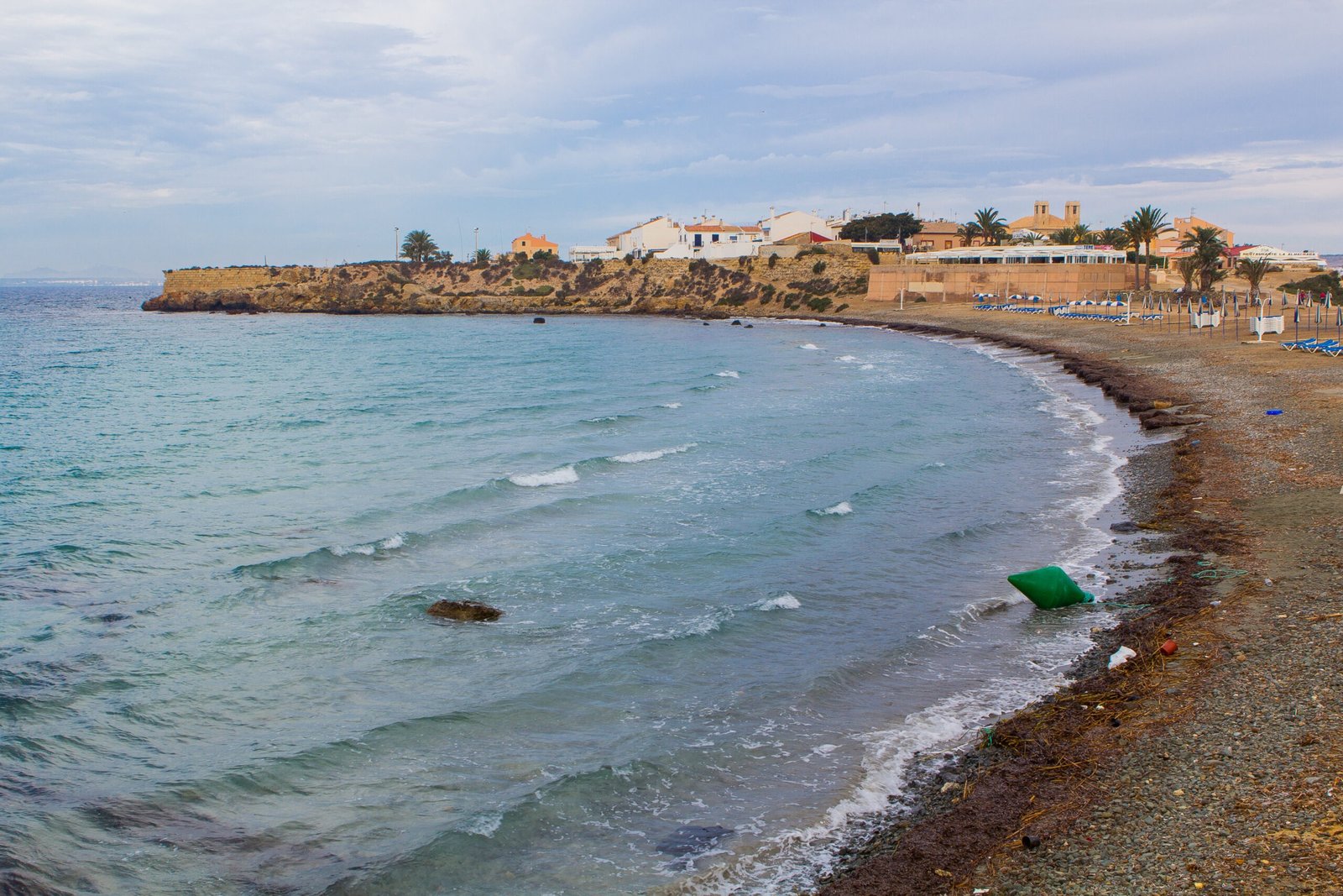
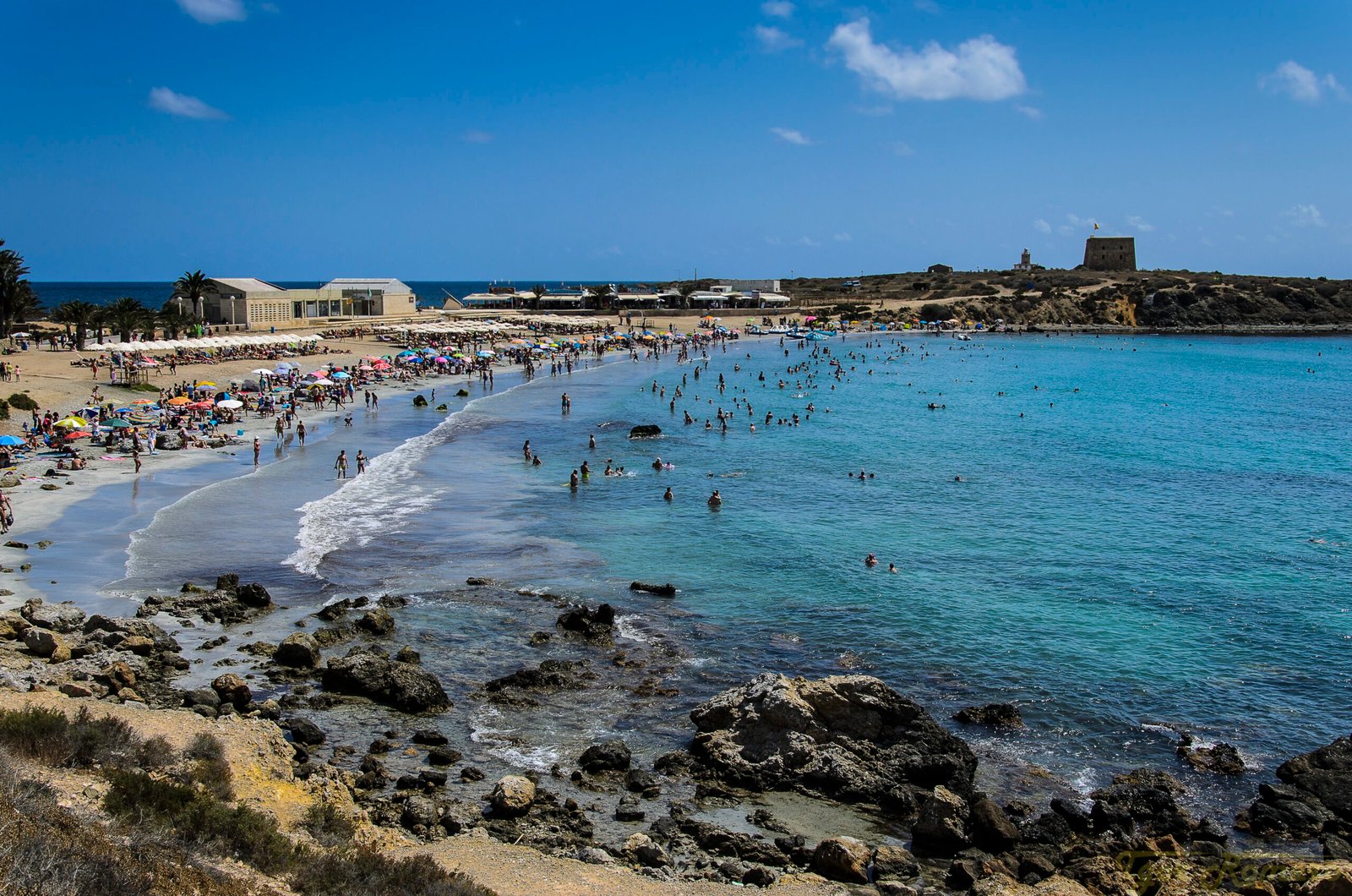
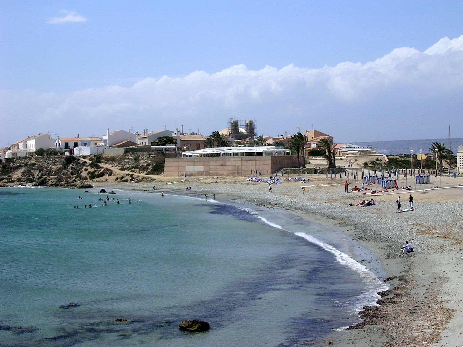
The beach of the only inhabited island in the Valencian Region: golden sand in front of the walled village of Nueva Tabarca, inside a Marine Reserve, with a 2026 Blue Flag and “Excellent” water in 2025.
2026 Blue Flag
Water: Excellent (2025)
Updated: November 2026
Google 4.3 ★ (747 reviews) · See on Google · checked 10/11/2026


Creator of Welcome to Alicante · Local guide
I’m Javier Mondéjar
I offer you local knowledge about Alicante, in this case its beaches. I haven’t visited every one of them, but I have been to most; even so, I know them because I’m from here, I’ve moved around, I’ve asked friends and family, and I also check official sources.
5+ countries
5 years of experience
1,500+ readers
Welcome to Alicante figures
Why is Tabarca beach special?
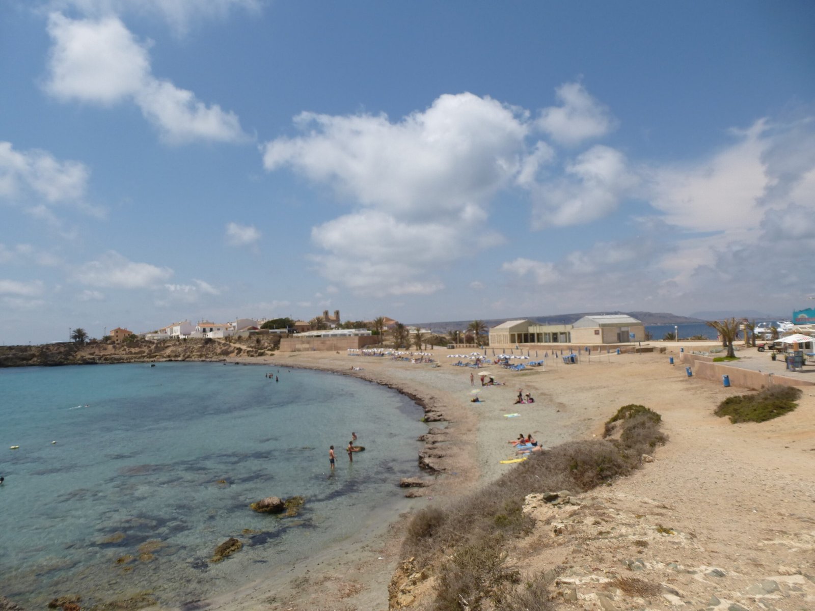
Tabarca beach (the island’s Playa Central) is a stretch of sand of about 200 × 20 m next to the harbour and the village of Nueva Tabarca, eleven nautical miles from Alicante. Of the Tabarca island beaches, it is the one by the village; its waters have been a Marine Reserve since 1986, and the seabed is among the richest on this coast for snorkelling.
You can’t drive here: the boat trip is part of the day. On the island you’ll find 18th-century walls (a Site of Cultural Interest), the museum, caldero rice at the harbour restaurants and, at night, the province’s first Starlight site.
• Marine Reserve: Protected waters since 1986, perfect for snorkelling
• 2026 Blue Flag: “Excellent” water in 2025 (Museo de Tabarca sampling point)
• Island with history: Listed walls and a village founded for Genoese fishermen
Why trust this guide
Personal experience
Local knowledge and official sources.
Exact location
Coordinates and routes.
Honest reviews
Real opinions.
Authentic photos
Up-to-date images.
Location and how to get to Tabarca beach
Tabarca Island, off Santa Pola, within the municipality of Alicante: although it is out at sea, Tabarca beach is an Alicante beach.
• GPS: 38.1657° N, 0.4788° W
• From the airport (ALC): ~14.7 km · From the centre: ~20.0 km · From Alicante-Terminal station: ~19.9 km (straight line)
• By plane: From Alicante-Elche airport (ALC), head to Santa Pola or Alicante harbour and take the boat. The straight-line distance (~14.7 km) is meaningless: the trip always includes a boat.
• By car: Cars are not allowed on the island. Park at the departure harbour (Alicante or Santa Pola); in Alicante, the Interparking Plaza del Puerto car park is right by the quays.
• Public transport: Boats from Alicante harbour (≈1 hour, Cruceros Kontiki), from Santa Pola (daily all year round) and, in season, day trips from Torrevieja (Marítimas Torrevieja). There is no direct boat from Benidorm or El Campello: those sailings are suspended until further notice (Excursiones Benidorm, 2026). Timetables and fares change every season: check with the operator before you go.
Parking and access
There is no parking on the island. Leave the car at the departure harbour.
• Reduced mobility: In summer there is an assisted-bathing point with amphibious chairs (1 Jul – 15 Sep, 10:00–18:00; Alicante Turismo). Boarding depends on the boat: check with the operator.
Services and facilities
Is there a lifeguard? Yes (15 Jun – 15 Sep, 11:00–19:00)
Are there toilets? Yes
Are there showers? No
Are there foot showers? Yes
Is there a beach bar? Yes
Can you rent sunbeds or umbrellas? Yes
Is there water-sports rental? Yes
Is it accessible for reduced mobility? Yes, assisted bathing in summer
Is there parking? No
Are dogs allowed? No (only 1 Nov – 1 Mar)
Does it have a 2026 Blue Flag? Yes
Is there a children’s play area? Yes
Extras: Marine Reserve since 1986 · Listed walls / historic ensemble · The province’s first Starlight site · Nueva Tabarca Museum (free entry) · Summer tourist info point: +34 965 177 201 · Alicante Turismo snorkel guide
Beach temperature and conditions (live)
Widget space (live air temperature, water temperature and other conditions). No fixed figures shown.
Air temperature
Widget space · live data
Water temperature
Widget space · live data
Other beach conditions
Widget space · live data
Water and sand quality
Bathing-water quality: Excellent (official 2025 classification, Alicante City Council / Generalitat Valenciana). Sampling point: M03014E1 Museo de Tabarca.
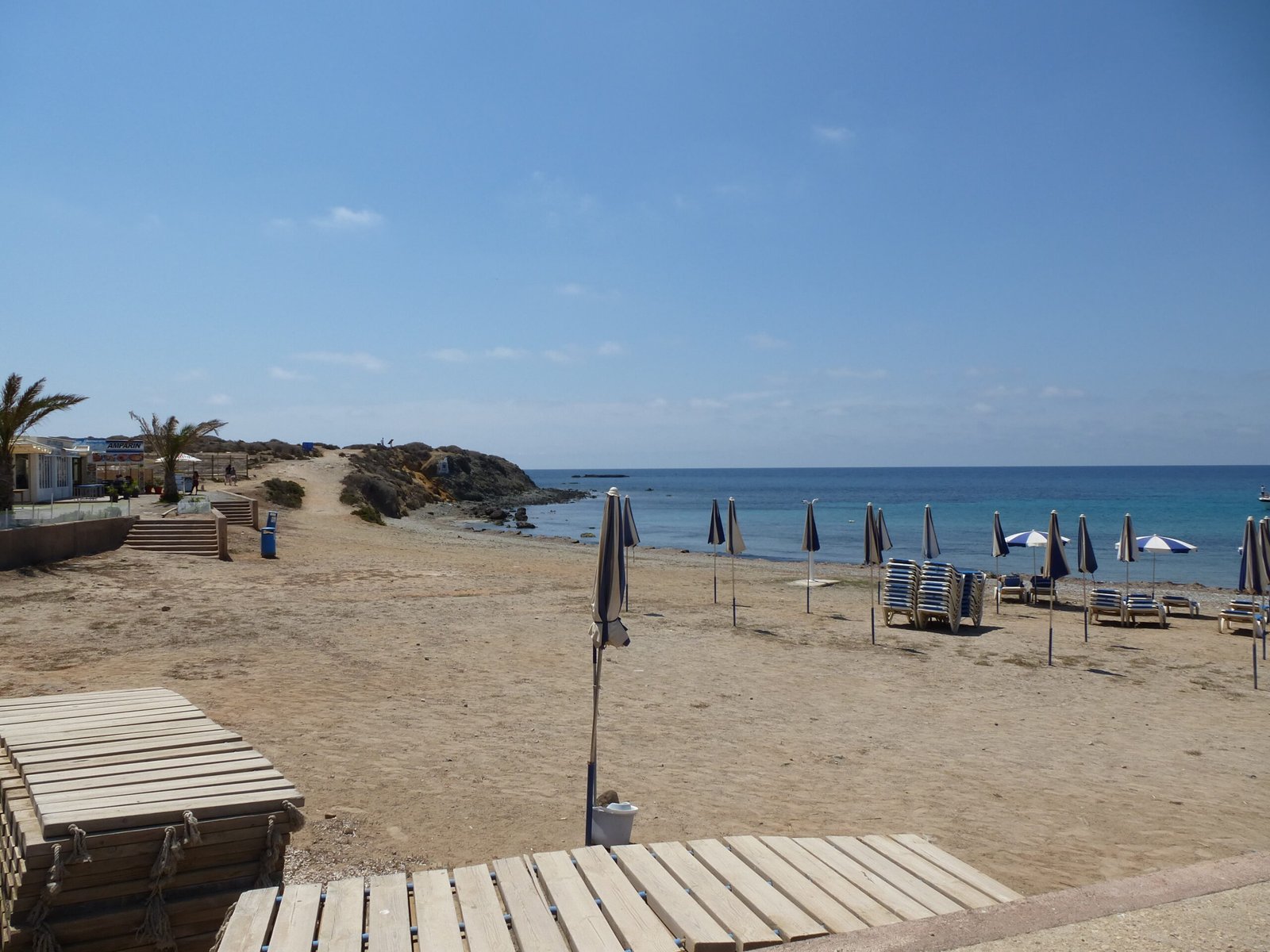
• Sand: Golden sand with gravel
Sea-state flags
Green flag
Swimming allowed: ideal conditions
Yellow flag
Caution: swim with care
Red flag
Swimming prohibited
What we think at Welcome to Alicante
For us, Tabarca is more of a day trip than a beach: what makes it unique is arriving by boat, swimming in the middle of a Marine Reserve and strolling through a car-free walled village. The beach itself is small (about 200 m), with some gravel, and it fills up in July and August, especially when the mid-morning boats arrive. We think it is ideal for a day of snorkelling, for couples or families with children who can already swim, and for a caldero lunch at the harbour. Our tip: catch one of the first boats, bring a mask and snorkel and, if you can, go in June or September.
Tabarca beach reviews: our rating
The most special beach in the municipality, thanks to the boat trip and the setting: Marine Reserve, walls and village. Small and crowded in summer; come early or outside July and August to enjoy it calmly.
• Google: 4.3 ★ · 747 reviews · Read reviews on Google
Quick facts and budget
Type: Island beach, semi-urban, by the village of Nueva Tabarca
Length × width: 200 m × 20 m
Crowds: High
Ideal for: Snorkelling, day trips and families
Nudism: No
Dogs: No (only 1 Nov – 1 Mar)
Best time: June – September (lifeguard season)
Budget: beach access free · the main cost is the return boat trip · sunbeds and harbour restaurants at tourist-area prices
In figures
200 m long · 20 m wide
~14.7 km from the airport · ~20.0 km from the centre
Water Excellent 2025
4.3 ★ Google (747)
Recommended activities
• Snorkelling in the Marine Reserve · Free (own gear) — Groupers, sea bream and octopus, according to Alicante Turismo’s snorkel guide.
• Nueva Tabarca Museum · Free — Open Wednesday to Sunday; winter 11:00–14:00 and 15:30–16:30; summer 11:00–14:00 and 16:00–18:30.
• Walk along the walls · Free — 18th-century listed historic ensemble.
• Stargazing · Free — The province’s first Starlight site; 360º virtual tour on Alicante Turismo.
Climate and best time to visit
Climate normals 1981–2010, AEMET station Alicante (8025): 2851 hours of sunshine and 311 mm of rain a year; average maximum of 30.8 °C in August and 17.0 °C in January.
| Month | Jan | Feb | Mar | Apr | May | Jun | Jul | Aug | Sep | Oct | Nov | Dec |
|---|---|---|---|---|---|---|---|---|---|---|---|---|
| Mean temp. °C | 11.7 | 12.3 | 14.2 | 16.1 | 19.1 | 22.9 | 25.5 | 26.0 | 23.5 | 19.7 | 15.4 | 12.6 |
| Mean max. °C | 17.0 | 17.6 | 19.6 | 21.3 | 24.1 | 27.8 | 30.3 | 30.8 | 28.5 | 24.9 | 20.5 | 17.7 |
| Rain mm | 23 | 22 | 23 | 29 | 28 | 12 | 4 | 7 | 56 | 47 | 36 | 25 |
| Sun hours | 181 | 180 | 227 | 247 | 277 | 302 | 330 | 304 | 250 | 217 | 173 | 164 |
Best time for swimming: June to September. September and October are the wettest months.
Local tips
• Take one of the first boats: the beach is small and gets very busy in summer.
• Bring a mask and snorkel. Use a buoy and stay out of the water when it is murky or rough (Alicante Turismo advice).
• For lunch, try caldero at the harbour. In July and August, book a table.
• Photo tip: the walls and the Levante gate at sunset.
Photo gallery
Frequently asked questions
Do you have to pay to get in?
No. It is a public, free beach; only optional services are paid.
Is there a lifeguard?
15 Jun – 15 Sep, 11:00–19:00
Can I take my dog to Tabarca beach?
Only from 1 November to 1 March, as on all Alicante beaches. In summer, the dog beach is Agua Amarga.
How do I get to Tabarca beach?
By boat from Alicante (≈1 h), Santa Pola (all year) or Torrevieja (in season). There are no cars on the island.
Are there places to eat?
Yes, restaurants in the village and harbour, right by the beach.
Other nearby beaches
• Puerto Viejo (Isla de Tabarca) · ~0.1 km · 30 m
• Urbanova (Los Saladares) · ~13.7 km · 1,600 m
• Agua Amarga · ~16.6 km · 250 m
Credits and sources
• Sources: Guía de Playas MITECO · Alicante Turismo · Ayuntamiento de Alicante · GVA · ADEAC · AEMET · OpenStreetMap · Google Maps (rating and count only).
Photos (in order of appearance):
• Hero · main: «Tabarca by Sergi Miró.jpg» — Sergio Miró · CC BY-SA 3.0 es · Wikimedia Commons
• Hero · secondary 1: «Playa de Tabarca.jpg» — Igor Romero · CC BY-SA 2.0 · Wikimedia Commons
• Hero · secondary 2: «Playa Tabarca.jpg» — benidormone · CC BY 2.0 · Wikimedia Commons
• Gallery 1: «Ile de tabarca , la plage – panoramio (3).jpg» — chisloup · CC BY 3.0 · Wikimedia Commons
• Gallery 2: «Ile de tabarca , la plage – panoramio.jpg» — chisloup · CC BY 3.0 · Wikimedia Commons
• Gallery 3: «Ile de tabarca , la plage – panoramio (4).jpg» — chisloup · CC BY 3.0 · Wikimedia Commons